by Eric Holthaus, Pacific Standard Magazine, August 12, 2016
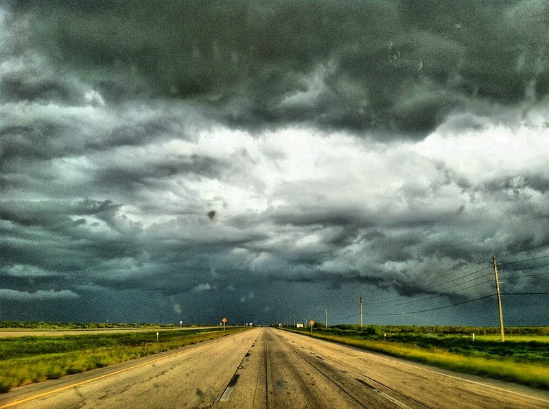
By mid-morning on Friday, more than a foot of rain had fallen near Kentwood, Louisiana, in just a 12-hour stretch — a downpour with an estimated likelihood of just once every 500 years, and roughly three months’ worth of rainfall during a typical hurricane season. It’s the latest in a string of exceptionally rare rainstorms that are stretching the definition of “extreme” weather. It’s exactly the sort of rainstorm that’s occurring more frequently as the planet warms.
In response to the ongoing heavy rains, Louisiana Governor John Bel Edwards declared a statewide state of emergency on Friday, and local governments are distributing sandbags, conducting water rescues, and facilitating evacuations. The New Orleans Times-Picayune is maintaining a live blog of the latest developments. The Tickfaw River north of New Orleans soared 18 feet in about 12 hours to a new record crest on Friday morning, beating the water level of April 1983, and 5 feet higher than the high-water mark during Hurricane Isaac in 2012, the last hurricane to make landfall in Louisiana.
Meanwhile, a lot more rain is still on the way. High-resolution weather models predict an additional one or two feet of rain by Saturday evening, a total the local National Weather Service referred to as “scarily high.” The NWS has issued its highest alert for excessive rain and warned of “significant to catastrophic flash flooding.” A “flash flood emergency” is in effect for the hardest-hit regions, a warning reserved only for the direst and most life-threatening events.
An instant analysis from Climate Nexus refers to today’s Louisiana rainstorm as a “classic signal of climate change.” It’s right.
Obviously, this is no ordinary storm. Though the overall structure of this meteorological event does not meet the technical requirements for a tropical storm or hurricane (it’s attached to a stalled weather front, for example), the NWS is treating it roughly the same way, and the physics of the rain clouds themselves are similar. (Tropical rain clouds are generally more efficient at converting cloud moisture into raindrops.)
This storm’s tropical nature, in combination with record-warm water temperatures just offshore in the Gulf of Mexico, are creating a nearly perfect environment for extremely heavy rain and record flooding in one of the wettest places in the country. As the atmosphere warms thanks to greenhouse gas emissions, it can hold more water vapor — and this effect makes it exponentially more likely that extreme rainfall events will occur. The weather balloon released on Friday morning from the New Orleans office of the NWS measured near all-time record levels of atmospheric moisture, higher than some measurements taken during past hurricanes. The NWS meteorologist who reported this morning’s reading remarked simply, “obviously we are in record territory.”
An instant analysis from Climate Nexus refers to today’s Louisiana rainstorm as a “classic signal of climate change.” It’s right. The NWS maintains a statistical database used to calculate the “annual exceedance probability” of a given rainfall event — basically, the expected frequency this event would occur in any given year.
Today’s rainstorm in Louisiana is at least the eighth 500-year rainfall event across America in little more than a year, including similarly extreme downpours in Oklahoma last May, central Texas (twice: last May and last October), South Carolina last October, northern Louisiana this March, West Virginia in June, and Maryland last month.
And these were just the events that the agency decided to write a report on. One notable exception to this list is the Tax Day Flood in the Houston metropolitan area this April, at least the fourth major flood in that region in a span of a year. The local flood control district extrapolated the 23.5 inches of rain over 14.5 hours in Pattison, Texas, during the Tax Day Storm to be a one-in-10,000-year event.
Statistical calculations like these make a major assumption: That the climate of the past is the same as the climate of today. That’s no longer a very good assumption.
https://psmag.com/americas-latest-500-year-rainstorm-is-underway-right-now-in-louisiana-98acbdf435d0#.uum50kkps


No comments:
Post a Comment